
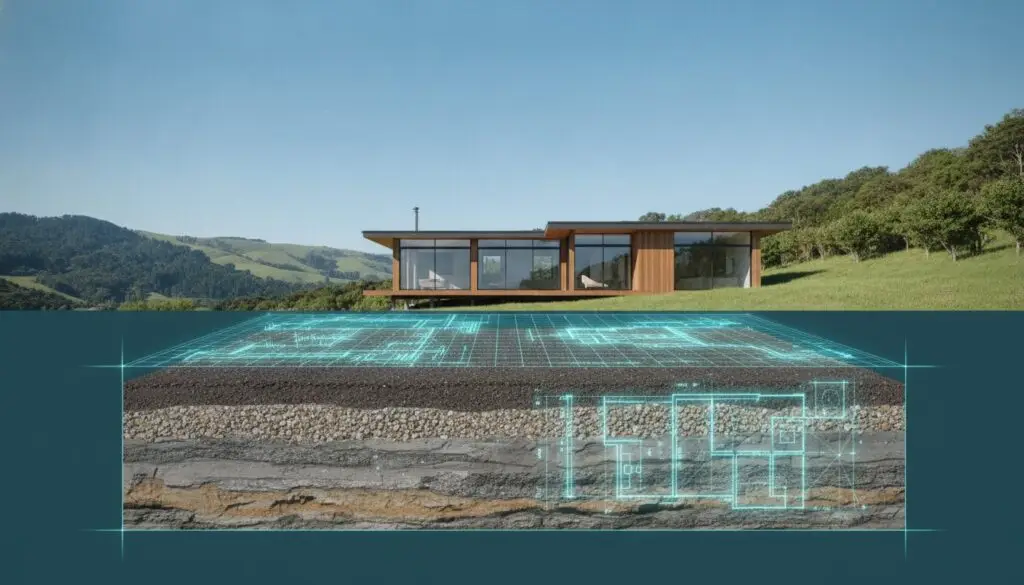
The most expensive mistake a New Zealand developer can make isn’t found in the architectural plans, but in the ground beneath them. While a building consent rejection can feel like a sudden roadblock, it is often just the result of unresolved site complexities. You likely understand that securing a geotechnical report for building consent is a mandatory step in the process, yet the technical jargon surrounding liquefaction and seismic hazards can make the path forward feel clouded. It’s common to feel a sense of apprehension about hidden ground costs or the fear that a council officer might find your data insufficient.
We believe that technical precision should bring peace of mind, not confusion. This guide is designed to help you navigate the intricate requirements of the Building Act 2004 and the latest MBIE modules with absolute certainty. You’ll gain a clear understanding of how professional assessments protect your structural integrity and streamline your application. By the end of this article, you will have a defined roadmap to ensure your foundation design is resilient, your risks are minimised, and your project remains firmly on solid ground.
Key Takeaways
- Understand why a geotechnical report for building consent is a vital strategic asset that ensures your site can safely support your proposed structure under all conditions.
- Learn the methodical phases of ground investigation, ranging from historical desktop research to precise physical fieldwork and engineering analysis.
- Discover how to identify and mitigate complex geohazards, such as slope stability issues and liquefaction risks, to protect your structural investment.
- Follow a clear, structured path to commissioning your assessment by integrating your architectural vision with professional engineering oversight.
- Recognise why partnering with a multi-disciplinary firm like Chambers Consultants Ltd provides the steady hand needed to transform technical uncertainty into structural security.
What is a Geotechnical Report for Building Consent?
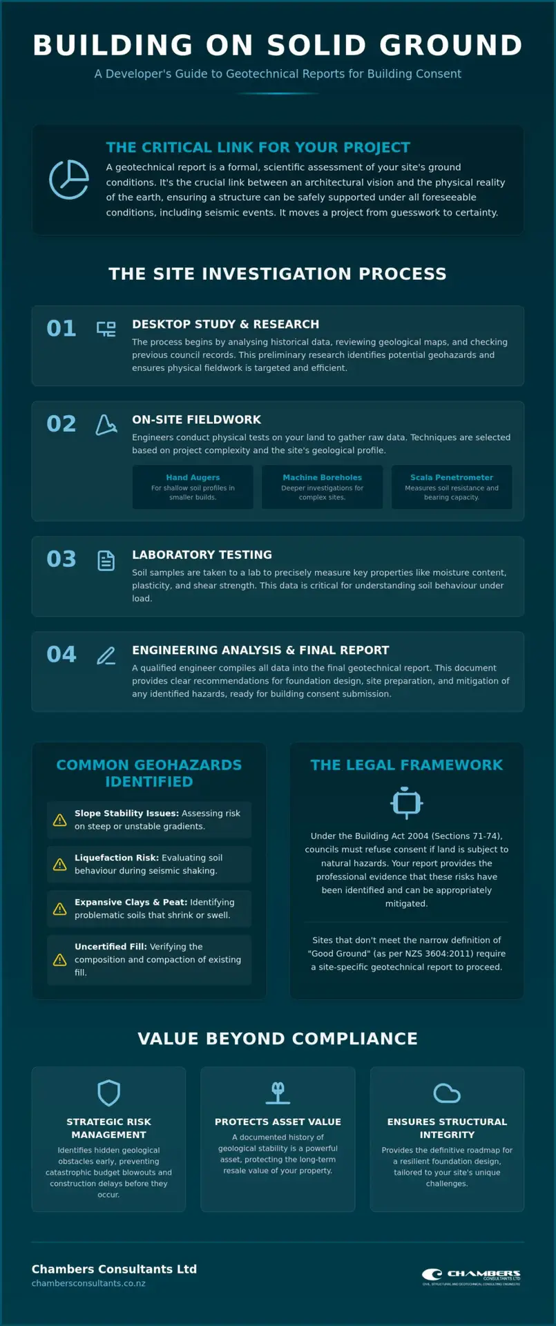
A geotechnical report for building consent is the critical link between your architectural vision and the physical reality of the earth. It is a formal, scientific document prepared by a qualified engineer that assesses site-specific soil conditions. Without this data, a project is effectively building on guesswork. The primary objective is to ensure the ground can support the proposed structure under all foreseeable conditions, including extreme weather and seismic events. While a preliminary assessment might offer a high-level overview for a property purchase, a full report for consent provides the granular detail required for specific foundation design.
The discipline of geotechnical engineering involves the study of soil and rock behaviour to determine how they will interact with man-made structures. This specific geotechnical report for building consent provides the data needed to transform these abstract geological principles into a safe, buildable reality. It moves beyond general observations to provide precise calculations for bearing capacity, settlement risks, and soil density.
The Legal Framework: Why Council Needs Your Report
New Zealand councils operate under a strict regulatory mandate to ensure public safety and asset longevity. Sections 71 to 74 of the Building Act 2004 are particularly significant; they require the Building Consent Authority (BCA) to refuse a building consent if the land is subject to natural hazards like erosion, falling debris, or inundation. Your report serves as the evidence that these risks have been identified and appropriately mitigated.
For many standard builds, developers look toward the NZS 3604:2011 standard. This standard provides “off-the-shelf” designs for timber-framed buildings, provided the site qualifies as “Good Ground.” However, “Good Ground” is a narrow definition. If your site features expansive clays, uncertified fill, or steep gradients, you must move beyond the standard and provide a site-specific geotechnical report for building consent. The BCA relies on this professional oversight to confirm that your foundation design is not only compliant but also resilient against the unique challenges of your section.
The Value Beyond Compliance
Viewed through a strategic lens, this assessment is an investment in risk management. It identifies hidden geological obstacles that could otherwise lead to catastrophic budget blowouts during the construction phase. Precision pays dividends. By identifying soft clay or peat layers early, you can adjust your design before the first shovel hits the ground. This proactive approach also protects the long-term resale value of your property. Just as ensuring structural stability is key, managing environmental health through experts like MouldMen can further safeguard your investment. A documented history of stability is a powerful asset in the New Zealand real estate market, and the report serves as a definitive roadmap for structural integrity and comprehensive risk mitigation.
The Site Investigation Process: What Happens on Your Land
A site investigation is a methodical progression from the known to the unknown. It begins long before any machinery arrives on site through a comprehensive desktop study. Engineers review historical data, geological maps, and previous council records to identify potential geohazards that might not be visible to the naked eye. This preliminary research ensures that the physical fieldwork is targeted and efficient, providing a clear context for the empirical data to follow.
Once on-site, the investigation becomes tactile. The techniques used are selected based on the complexity of your project and the specific geological profile of your land. This phase is about gathering raw data that will eventually form the backbone of your geotechnical report for building consent. Following the fieldwork, soil samples are often taken to a laboratory to test for moisture content, plasticity, and shear strength. These tests provide the precision needed to understand how the soil will behave under the weight of a new structure.
Common Fieldwork Methods Explained
The tools used during an investigation vary depending on the depth required and the nature of the soil. Hand augers are frequently used for residential extensions or smaller builds; they allow engineers to assess shallow soil profiles with minimal site disruption. For deeper investigations or complex commercial developments, machine boreholes become necessary to reach more stable strata. Throughout this process, Scala Penetrometer tests are conducted to measure the resistance of the soil. These tests provide an immediate indication of the ground’s bearing capacity, ensuring that the foundations are anchored in reliable material.
If you are looking for clarity in these early stages, our team provides expert foundation design services that bridge the gap between raw site data and practical construction solutions.
Data Interpretation: Turning Soil into Strategy
The final phase of the process is where raw numbers are transformed into a strategic construction plan. Engineers use the gathered data to calculate the ultimate bearing capacity, which dictates the type and size of foundations your project requires. Monitoring groundwater levels is equally critical; water table fluctuations can significantly impact site stability and long-term settlement.
Finally, the engineer determines the seismic site subsoil class. This classification is essential for meeting New Zealand’s rigorous seismic standards, as it dictates how your building must be engineered to withstand earthquake forces. By the time your geotechnical report for building consent is finalised, every variable of your site’s geology has been accounted for, leaving no room for structural uncertainty.
Addressing Hazards: Slope Stability and Seismic Risks
Building in New Zealand requires a deep respect for the land’s inherent volatility. While the aesthetic appeal of a hillside section or a coastal plot is undeniable, the geological reality often demands rigorous scrutiny. A geotechnical report for building consent is the primary tool used to identify and quantify these environmental risks before they become structural failures. Beyond the basic soil strength discussed in previous sections, this phase of the assessment focuses on the dynamic forces that could compromise your building’s future, ensuring that your investment is grounded in certainty.
The interaction between a structure and its environment is most critical when the terrain is challenging. Engineers don’t just look at the site as it exists today; they model how it will perform under the stress of extreme weather and tectonic shifts. This forward-thinking approach transforms potential geohazards into manageable engineering puzzles. By addressing these risks during the design phase, you avoid the prohibitive costs of retrospective structural repairs or, worse, a building consent rejection late in the project timeline.
Slope Stability and Remediation
Evaluating slope stability involves calculating the “factor of safety” for your specific building platform. It’s a precise measure of whether the driving forces of gravity and water pressure are sufficiently countered by the resisting forces of soil and rock. When building on or near hillsides, engineers must account for the long-term interaction between planned earthworks and the natural terrain. Engineering solutions for landslips might involve sophisticated retaining structures or reinforced earth systems. These designs ensure that the integrity of the slope remains intact even during periods of heavy saturation, providing a secure, permanent platform for your development.
Managing Liquefaction and Ground Failure
Seismic resilience is a non-negotiable standard in the New Zealand Building Code. During an earthquake, certain low-lying or sandy soils can lose their strength and behave like a liquid, a process known as liquefaction. Managing this risk requires a strategic approach that aligns with the MBIE Earthquake Geotechnical Engineering Practice Series, specifically the revised modules released in late 2021. Your geotechnical report for building consent will detail whether your site requires specialised foundations, such as deepened piles or compensated raft systems, to mitigate ground failure.
Managing settlement risks is equally vital, particularly in regions with soft clay or organic peat. Uneven sinking can lead to structural failure, yet it’s entirely preventable with accurate data. By integrating seismic design with structural engineering, we move beyond mere identification of hazards. We provide a clear path to stability, transforming a site’s geological weaknesses into a managed, engineered asset. This comprehensive oversight ensures your project meets the highest safety standards while protecting your long-term property value.
Steps to Secure Your Geotechnical Report
Securing a geotechnical report for building consent is a methodical sequence that transforms architectural concepts into a compliant reality. The process begins with a robust design brief. Sharing your architectural plans with your geotechnical engineer allows them to align their investigation with the specific footprint and load requirements of your structure. This early transparency ensures the testing is targeted, which prevents the need for expensive, retrospective site visits if the design footprint shifts later in the project.
Once the physical site investigation is complete, reviewing the draft report is a vital quality-control step. You must ensure that every proposed element, from the primary dwelling to ancillary structures like retaining walls, pools, and driveways, is explicitly covered. After the final report is issued, your engineer often acts as a professional bridge between your project and the local council. They handle Requests for Information (RFIs), ensuring that any technical queries from the Building Consent Authority are resolved promptly to keep the statutory processing clock moving.
Collaborating with Your Design Team
Efficiency in construction is born from collaboration. When your structural engineer and geotechnical expert work in unison, they can optimise foundation designs, often reducing material costs without compromising safety. This partnership ensures that the topographic survey data aligns perfectly with the geotechnical findings. By synchronising these disciplines, you create a seamless data flow that minimises the risk of structural failure and avoids the hidden costs of over-engineering. If you are ready to begin this process, our land and subdivision development surveying experts can help ground your project in precision from day one.
Understanding Report Types
It’s essential to distinguish between the two primary documents in the project lifecycle to avoid confusion during the final stages of your build. The Geotechnical Assessment Report (GAR) is the document required for the initial building consent application; it provides the data and recommendations for the design phase. In contrast, the Geotechnical Completion Report (GCR) is produced after earthworks are finished to verify that the ground conditions encountered meet the original design specifications. A GCR is often the final hurdle for your Code Compliance Certificate (CCC). This document provides the ultimate assurance to both the council and future owners that the building platform is stable and the foundations are secure.
Why Chambers Consultants Ltd is the Steady Hand for Your Project
Engineering excellence is built on a foundation of stability and long-standing expertise. Chambers Consultants Ltd brings over 50 years of heritage to the New Zealand development sector, providing a level of reliability that only decades of experience can foster. We understand that a geotechnical report for building consent is more than just a regulatory requirement; it’s a strategic asset that ensures the safety of your investment. Our national reach and reputation for meticulousness allow us to serve as a stabilising force in an industry that demands absolute precision and integrity. This legacy isn’t just about the past; it’s about the steady hand we provide for your future.
We believe in transforming complex geological data into clear, actionable building solutions. Our team doesn’t just deliver technical reports; we provide the clarity needed to navigate the most intricate site challenges. By maintaining a high professional register and a commitment to meticulous detail, we ensure that every client feels supported by a seasoned mentor. This perspective allows us to solve complex puzzles while remaining focused on your specific project vision.
The Advantage of Integrated Engineering
Efficiency is found in the synergy between disciplines. Our multi-disciplinary approach integrates geotechnical, structural, and land development expertise under one roof, which significantly reduces project friction and miscommunication. Internal collaboration between our surveyors and engineers ensures that your consent process is streamlined and that data is interpreted with total accuracy. This integrated model is particularly effective when managing high-stakes requirements like seismic design and retrofitting or complex slope stability assessment services. We manage the entire progression from the initial investigation to the final completion, ensuring a seamless transition between phases that protects your timeline.
Partnering for Success
We act as your trusted advisor throughout the development lifecycle, transforming intricate puzzles into clear paths forward. Navigating the specific demands of local councils requires a steady hand and a clear-thinking strategist who understands the nuances of the Building Act. We remain focused on your vision while ensuring that every aspect of your project meets the highest standards of structural safety and environmental resilience. Our collaborative approach values long-term trust and precision, positioning your development for success from the ground up. If you’re ready to move forward with certainty, you can secure your building consent with an expert geotechnical report from Chambers Consultants Ltd.
Grounding Your Development in Professional Certainty
Navigating New Zealand’s land development landscape requires more than just vision; it demands a precise understanding of the ground beneath your feet. We’ve explored how a methodical investigation transforms geological uncertainty into a strategic asset. By identifying hazards like liquefaction or slope instability early, you protect both your construction budget and the long-term structural integrity of your build.
A professional geotechnical report for building consent is the definitive roadmap that guides your project through council scrutiny and toward a successful completion. Established in 1974, Chambers Consultants Ltd provides a multi-disciplinary engineering and surveying team with deep expertise in slope stability and foundation design. We bring decades of technical wisdom to every project, ensuring your site is resilient and your pathway to consent is clear. Partner with Chambers Consultants Ltd for your Geotechnical Assessment and gain the peace of mind that comes from 50 years of technical excellence. Your project deserves a foundation built on integrity and meticulous precision.
Frequently Asked Questions
How much does a geotechnical report cost for a standard residential build?
For a standard residential project on a flat site, a geotechnical report typically costs between NZ$1,500 and NZ$3,500 plus GST. Costs can be lower, in the NZ$1,000 to NZ$2,500 range, for simpler sites with easy access and known soil profiles. However, complex sections with difficult access, poor soil conditions, or potential geohazards will require more intensive testing and analysis, which increases the total fee. Every section presents unique challenges, so the final price reflects the specific level of investigation required for your land.
How long does it take to receive a completed geotech report?
You can generally expect to receive a completed report within two to four weeks from the date the physical site investigation is carried out. This timeframe allows for the initial fieldwork, any necessary laboratory analysis of soil samples, and the detailed engineering calculations required to produce a robust document. It’s wise to book your assessment early in the design phase, as driller availability and weather conditions can sometimes impact the initial start date of the fieldwork.
Can I use a geotech report from a previous owner or a nearby site?
You shouldn’t rely on a report produced for a neighbouring property or a previous owner without professional verification. Soil conditions can change significantly over just a few metres, and a report must be specifically addressed to the current project and owner to be accepted by the Council. While an existing report for your specific section can provide a useful baseline, an engineer will usually need to review and update it to ensure it meets current Building Code standards and reflects the current state of the land.
What is “Good Ground” and does it mean I don’t need a report?
“Good Ground” is a technical term defined in NZS 3604:2011 that refers to soil capable of supporting a standard timber-framed building without specific engineering design. Even if you suspect your section meets this criteria, the Building Consent Authority often requires professional confirmation before they will accept your application. If your site features expansive clays, uncertified fill, or is prone to liquefaction, it won’t qualify as “Good Ground,” making a formal geotechnical report for building consent a mandatory requirement.
Does a geotech report guarantee that my building consent will be approved?
A report provides the necessary scientific evidence for the ground stability portion of your application, but it doesn’t guarantee overall consent approval. Its primary role is to demonstrate to the Council that all natural hazards have been identified and that the proposed foundations are appropriate for the site. While it removes a major technical hurdle, your project must still comply with all other regulations, including architectural standards, drainage requirements, and local district plans. It’s one critical piece of a larger regulatory puzzle.
What happens if the report identifies significant hazards like liquefaction or instability?
If significant hazards are identified, the report will outline specific engineering solutions to mitigate these risks and ensure the safety of your structure. This might involve designing specialised foundations, such as deepened piles or raft systems, or implementing ground improvement techniques to stabilise the soil. For sites affected by slope movement, understanding the full range of engineering solutions for landslips can help you evaluate the remediation options available before committing to a construction approach. While these measures can impact your construction budget, they provide the technical pathway needed to transform a challenging site into a buildable reality that meets modern seismic and safety standards.
Is a geotech report required for a simple retaining wall or garage?
A report is frequently required for smaller structures if they involve significant earthworks or are situated on or near sloping ground. For example, a retaining wall where it’s possible to fall more than 1.5 metres requires a building consent, and the Council must be certain the wall won’t compromise the stability of the surrounding land. Even for a garage, if the ground is known to be soft or unstable, professional oversight is necessary to ensure the foundations don’t fail over time.
How long is a geotechnical report valid for in New Zealand?
There’s no strict statutory expiry date, but most New Zealand councils consider a geotechnical report for building consent to be “stale” after two to five years. If significant earthworks have occurred on the site or if there have been major seismic events since the original investigation, the data may no longer be accurate. It’s best to have a qualified engineer review any report older than a few years to ensure it still complies with the latest MBIE practice modules and accurately reflects the current site conditions.