



























Land Surveying Services

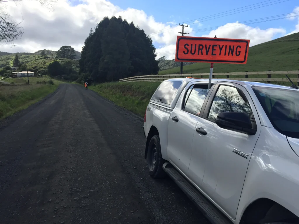
At Chambers, our surveying services give you the precision and confidence you need at every stage of your project ,from initial planning to final delivery. We make sure all spatial data matches your design vision and meets regulatory requirements. With our experienced team on-site, you get accurate measurements, expert guidance, and reduced risks, helping you make smart, informed decisions throughout your entire project.

land surveying banner icon 3

What We Do for Land Sureveying Services

At Chambers, we specialize in delivering precise and reliable surveying services that form the foundation for successful projects across various industries. Our expert team utilizes the latest technology and methodologies to provide accurate spatial data and detailed site information that empower you to make informed decisions throughout the project lifecycle.

Our core surveying services include:

land surveying services

Topographic & Engineering Surveys

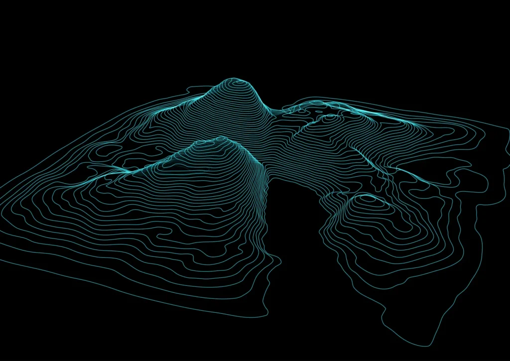
Our detailed topographic surveys capture site contours, elevations, and existing features to support civil works, cut and fill analysis, and site setout for construction.


land surveying services

Land Development & Subdivision

We assist in the design and planning of land subdivision projects, ensuring accurate boundary identification and certification.

land surveying services

Construction & Monitoring

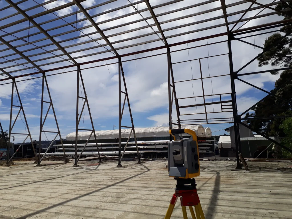
Our construction surveying services include precise building setout, deformation and settlement monitoring, and establishing control networks.


land surveying services

Cadastral Surveying

We provide legal boundary definitions and redefinitions, prepare land title plans, and manage survey lodgements with regulatory authorities.


land surveying services

Reality Capture & 3D Scanning

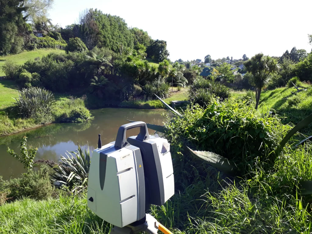
Utilizing high-resolution laser scanning and point cloud processing, we create detailed 3D CAD/BIM models and Revit-ready datasets.

land surveying services

Geodetic & GNSS Surveys

We offer GPS/GNSS control surveys for establishing accurate reference points, vertical datum transfers, and boundary surveys for rural and large sites.


land surveying services

GIS Data & Spatial Deliverables

We develop custom GIS databases with thematic layers tailored to your analysis and planning needs.

With a commitment to precision, reliability, and client collaboration, we at Chambers delivers surveying services and solutions that support your project goals from concept through completion. Contact us today to discuss how we can assist you with your surveying needs.

Our Key Surveying Services

Land Development icon

Land Development & Subdivision

  • Subdivision Design & Scheme Plans
    We prepare initial land subdivision layouts that align with engineering standards, zoning regulations, and council requirements, ensuring a smooth consent and development process.
  • Boundary Identification & Certification
    Accurate identification and certification of property boundaries for legal registration and future development planning.
  • Cross Lease Updates & Conversions
    We convert outdated cross leases into simpler and more marketable title structures such as fee simple or unit titles, increasing land value and simplifying ownership.
  • Unit Title Surveys
    Preparation of precise surveys for multi-unit developments, ensuring each unit is individually titled and compliant with legal standards.
  • Easement & Covenant Plans
    Surveying and mapping of legal easements and land covenants for services, access, or use restrictions, ready for legal registration.
  • Council Consent Support
    We prepare all required survey documents and work closely with local councils to support your application and ensure faster approvals.
Topographic icon

Topographic & Engineering Surveys

  • Detailed Topographic (Site) Surveys
    Comprehensive site surveys capturing existing features, structures, vegetation, and terrain, critical for design and planning.
  • Contour and Level Plans
    Creation of contour maps and level data to analyze slope, drainage, and site elevations for civil or architectural design.
  • As-built Surveys for Civil Works
    Documenting the actual built conditions on-site to verify conformance with design plans and compliance requirements.
  • Cut & Fill (Volume) Analysis
    Accurate calculation of earthwork volumes to support cost-effective site grading, excavation, and backfill operations.
  • Height in Relation to Boundary (HIRTB) Reports
    Reports analyzing building height relative to boundaries, ensuring compliance with district plan rules and sunlight access standards.
  • Site Setout for Construction
    On-site marking of structures, boundaries, roads, and infrastructure as per construction plans for accurate execution.
Cadastral icon

Cadastral Surveying

  • Legal Boundary Definition & Redefinition
    Establishing and redefining legal land boundaries using accurate survey methods based on title documentation and fieldwork.
  • Land Title Plans (LT, DP, SO)
    Preparation of official survey plans for subdivisions, boundary adjustments, and other land transactions.
  • Survey Lodgements with LINZ
    Managing the submission of survey datasets to Land Information New Zealand (LINZ) for legal registration and title updates.
  • Encroachment & Occupation Surveys
    Identifying and documenting any unauthorized use or encroachment onto adjacent properties to support dispute resolution.
  • Boundary Realignments & Amalgamations
    Surveying and designing the merging or adjustment of property boundaries for compliance and land optimization.
construction monitoring icon

Construction & Monitoring

  • Building Setout and Construction Control
    Precise on-site marking and alignment of building elements to ensure construction adheres to design plans.
  • Deformation & Settlement Monitoring
    Monitoring structural movement or ground settlement over time to detect shifts, prevent damage, and ensure safety.
  • Precise Control Networks
    Establishing high-accuracy control points and geodetic networks to support all stages of construction and design.
  • Regular Site Visits During Critical Stages
    Frequent survey inspections during key phases of construction to maintain project accuracy and reduce errors.
  • Pre and Post Construction Surveys
    Baseline and final surveys that document site conditions before and after construction for compliance and validation.
Geodetic icon

Geodetic & GNSS Surveys

  • GPS/GNSS Control Surveys
    Establishing accurate geospatial control using high-precision satellite positioning systems.
  • Vertical Datum & Benchmark Transfers
    Transferring height and level references from known benchmarks to ensure elevation consistency across your site.
  • Rural and Large Site Boundary Surveys
    Surveying large properties or rural land with a focus on regulatory compliance, access, and subdivision readiness.
  • Coordinate System Conversions
    Converting between local, national, and international coordinate systems to support seamless spatial integration.
3D Scanning icon

Reality Capture & 3D Scanning

  • High-Resolution Laser Scanning (Terrestrial & Mobile)
    Capturing detailed 3D spatial data using fixed and mobile laser scanners for accurate digital representation of existing conditions.
  • Point Cloud Capture & Processing
    Generating and processing point cloud data to support digital modeling, clash detection, and virtual analysis.
  • 3D CAD/BIM Model Creation
    Creating intelligent 3D models in CAD and BIM formats for use in architecture, engineering, and construction workflows.
  • Revit-Ready Datasets
    Supplying data formatted specifically for Revit to streamline design and documentation processes.
  • 360° Photo Walkthroughs & Digital Twins
    Delivering immersive 360-degree imagery and virtual twin models to visualize and manage project environments remotely.
Spatial Deliverables icon

GIS Data & Spatial Deliverables

  • Custom GIS Database Creation
    Designing project-specific GIS databases with spatial relationships, metadata, and structure tailored to your needs.
  • Thematic Layers for Planning and Analysis
    Developing specialized GIS layers for land use, zoning, infrastructure, or environmental analysis.
  • Compatible with ArcGIS, QGIS, and Other Platforms
    We deliver GIS data in widely supported formats for seamless integration with platforms like ArcGIS, QGIS, and others.
  • Attribute-Rich Data Tied to Real-World Coordinates
    Our data includes comprehensive attribute information linked directly to geographic coordinates.
  • Available on Request for Any Survey Type
    We can provide GIS-compatible outputs for any type of survey project upon request.

How We Do Our Surveying Services

At Chambers, precision and reliability are at the heart of everything we do. Our approach to surveying services  combines advanced technology, industry expertise, and a commitment to excellence to deliver accurate and actionable data that drives successful outcomes for your projects.

land surveying services

3. High-Precision Field Surveying

Our team deploys advanced surveying equipment (including GPS/GNSS systems, robotic total stations, terrestrial laser scanners, and drones) to collect highly accurate spatial and topographic data.

land surveying services

2. Site Reconnaissance & Planning

Before any fieldwork begins, we review existing site data, assess access logistics, and develop a tailored survey strategy that ensures safety, efficiency, and accuracy in data collection.

Recommend Remedial Solutions

1. Client Consultation & Project Understanding

Every project starts with a thorough discussion to understand your specific goals, constraints, and regulatory requirements. We listen closely, ask the right questions, and align our services with your vision.

land surveying services

6. Ongoing Support & Collaboration

Our work doesn’t stop at delivery. We remain engaged throughout your project, offering continued support for design updates, construction changes, and council interactions. We’re your long-term surveying partner.

Initial Consultation

5. Deliverables & Reporting

We deliver clean, clearly structured outputs (whether it’s CAD plans, BIM models, GIS layers, or certified legal documentation) formatted for compatibility with your design, planning, or construction platforms.

land surveying services

4. Data Processing & Quality Assurance

We process all captured data using industry-standard software to generate 2D plans, 3D models, and GIS datasets. Rigorous internal checks ensure data accuracy, consistency, and compliance with project specifications.

Innovation & Technology for Surveying Services

At Chambers, innovation is embedded in every survey we deliver. We invest in cutting-edge technology and digital workflows to provide our clients with faster, more accurate, and more insightful surveying services and solutions. Our commitment to staying at the forefront of the industry ensures your projects benefit from the latest advancements in data capture and spatial intelligence.

Advanced Equipment

Advanced Surveying Equipment

Advanced Surveying Equipment

  • We utilize state-of-the-art tools to capture the most accurate data in the field.

Reality & Laser Capture

Reality Capture, Laser Scanning

Reality Capture, Laser Scanning

  • Our reality capture capabilities allow us to generate rich digital models of real-world conditions using high-resolution terrestrial and mobile scanners.

Smart Data Processing

Smart Data Processing

Smart Data Processing

  • Using industry-leading software like AutoCAD Civil 3D, Revit, Trimble Business Center, Leica Cyclone, and ArcGIS, we process complex datasets into structured deliverables ready for use in engineering, architecture, or construction.

Cloud-Based Collaboration

Cloud-Based Collaboration

Cloud-Based Collaboration

  • We offer cloud access to deliverables for real-time collaboration with your team—whether you're on site, in the office, or working remotely.

What Our Surveying Services Provide & Why They Matter

At Chambers, our surveying services do more than just measure land they lay the foundation for informed decision-making, regulatory compliance, and successful project delivery. Whether you’re developing a new subdivision, designing a structure, or managing an existing asset, our surveys provide the critical data you need accurate, timely, and project-ready.

  • Accurate Spatial Data
    Every project begins with precise data. Our surveys capture detailed measurements of land features, boundaries, topography, and structures with high levels of accuracy.
  • Certified Legal Documentation
    From boundary redefinition to subdivision plans, we provide fully certified cadastral surveys that meet legal standards for land registration and property transactions.
  • Digital Mapping & Models
    We deliver data in a wide range of digital formats (2D CAD plans, 3D point clouds, BIM models, and GIS-ready files) to support seamless integration into your workflows.
  • Construction-Ready Layouts
    Our construction setout services ensure that your build starts on solid ground, aligning precisely with design plans and minimizing costly on-site errors.
  • Regulatory Support
    We assist with council consents and compliance documentation, making the permitting process smoother and more predictable.
  • Monitoring & Ongoing Surveying
    We offer continued monitoring and verification services throughout construction or over time, ensuring safety, structural stability, and accountability.
  1. Minimize Risk
    With clear, accurate data, you reduce the risk of costly design errors, construction disputes, or compliance failures. Our surveying services help you avoid surprises.
  2. Improve Decision-Making
    Detailed spatial information empowers engineers, architects, planners, and contractors to make confident, data-driven decisions at every stage.
  3. Accelerate Project Timelines
    We streamline surveying services and documentation so your project moves from concept to completion faster with fewer delays.
  4. Ensure Legal Clarity
    Accurate boundary definition protects against encroachments, ownership disputes, and title issues that can delay or derail development.
  5. Optimize Land Use
    Our surveying services support better land development planning, helping you make the most of every square meter whether through smart subdivision or strategic boundary realignment.
  6. Support Sustainability & Compliance
    Our elevation, drainage, and GIS data support sustainable design and environmental compliance from stormwater management to daylight analysis.
  7. Enable Future-Proofing
    With high-resolution scans and BIM-ready models, you’ll have the data needed not only for today’s project but for future modifications, expansions, or maintenance.
land surveying services

Industries We Serve

At Chambers, our surveying services expertise supports a diverse range of industries each with unique challenges, regulations, and technical demands. With precision, innovation, and deep industry understanding, we deliver tailored solutions that align with your sector’s specific needs.

infrastructure development

Construction & Infrastructure

We work closely with civil engineers, contractors, and project managers to provide the accurate site data and setout services required for successful builds.

Real Estate Developers

Property Development & Real Estate

Developers and property professionals rely on us for boundary identification, subdivision design, and title documentation.

Architecture & Engineering

Architecture & Engineering

We provide architects and design teams with detailed topographic data, 3D models, and BIM-ready datasets to support accurate and efficient planning.

Government & Municipalities

Government & Public Sector

Our services support local councils, transportation agencies, and government planners with reliable data for infrastructure maintenance, regulatory planning, and public safety initiatives.

Environmental & Agricultural

Environmental & Agricultural

For large-scale land management, conservation efforts, and rural developments, our surveys deliver critical data for terrain modeling, land use planning, and environmental assessments.

Industrial & Utilities

Industrial & Utilities

We support energy, utility, and industrial facility projects with high-accuracy spatial data for infrastructure planning, asset monitoring, and safety compliance.

Why Surveying Services Are Important

Surveying is the foundation of every successful land, design, and construction project. It plays a critical role in turning concepts into reality ensuring every structure is built in the right place, on solid legal and physical ground, with complete confidence in the spatial data behind it.

At Chambers, we understand that precise measurement isn’t just a technical requirement it’s a strategic advantage.

land surveying services

Legal Clarity & Land Ownership

Cadastral surveys define property boundaries, settle disputes, and protect legal rights. Without professional surveying, land transactions and developments can face serious setbacks from title issues to costly litigation. Our certified plans ensure everything is aligned with property law and national standards.

Custom Planning & Design

Essential for Design, Engineering & Construction

Surveying links the digital design world with the physical environment. Architects and engineers rely on high-quality survey data to model site conditions, understand terrain, and design to fit real-world constraints. Construction teams need precise setout and control to ensure that what’s built matches the plan exactly.

Digital Documentatio

Accurate Information for Confident Decision-Making

Whether you’re developing a new property, expanding infrastructure, or reconfiguring a site, surveying provides the accurate spatial data required to plan, design, and build with certainty. It removes guesswork, minimizes risk, and ensures that each decision is backed by measurable insight.

hands-using-technology-renewable-resources

Supporting the Entire Project Lifecycle

Surveying isn’t a one-time task it supports every phase of your project. From initial feasibility to construction setout and final compliance checks, survey data is continuously needed to validate progress and maintain accuracy across all stakeholders.

land surveying services

Improving Efficiency & Reducing Costs

By identifying constraints early and preventing layout errors, surveying reduces delays, rework, and budget overruns. The insights we provide upfront help projects run smoother, faster, and more cost-effectively.

project management services

Enabling Sustainable Development

Topographic surveys, elevation models, and GIS data support smart planning and environmental responsibility. From managing stormwater to optimizing land use, surveying provides the information needed to build sustainably and responsibly.

In short, surveying is not just about measuring land it’s about building certainty.
With professional surveying services from Chambers, you gain clarity, control, and confidence at every stage of your project.

FAQs

Have questions? We have answers:

What is land surveying, and why do I need it?

Land surveying is the process of measuring and mapping land and property to determine boundaries, topography, and other spatial features. You need it for activities like building, subdividing, buying or selling property, or resolving boundary disputes. It ensures legal accuracy, design alignment, and construction success.

You should hire a surveyor at the very beginning of any project that involves land use, construction, or property transfer. Early surveys help identify legal boundaries, topographical features, and site constraints allowing architects, engineers, and planners to make informed decisions from day one.

We offer a full range of professional surveys, including:

  • Topographic & site surveys

  • Subdivision and boundary surveys

  • Construction setout and monitoring

  • As-built surveys

  • 3D laser scanning and point cloud capture

  • GNSS/geodetic control surveys

  • GIS data preparation

Each service is tailored to your project’s specific needs.

We use advanced equipment like GNSS systems, robotic total stations, and 3D laser scanners to ensure high levels of accuracy often within a few millimeters. Our data undergoes rigorous quality control checks to meet legal, engineering, and construction standards.

For more detailed answers, please visit our dedicated FAQ page or contact our team directly.

Contact Us

Ready to ensure your construction project meets every design and quality standard? Reach out today to discuss your construction support needs, request a quote, or learn more about our comprehensive services.

contact with us

Name(Required)

Our Other Services

Civil Engineering icon

Civil Engineering

Geotechnical engineering icon

Geotechnical Engineering

Structural Engineering icon

Structural Engineering

28 Responses

    1. 3D laser scanning captures millions of precise points from a site, creating highly detailed digital models. Unlike traditional surveying, which relies on discrete measurements, laser scanning records complete surfaces and features, reducing human error and providing a more accurate, comprehensive representation for design, construction, and analysis.

    1. Yes! Our GIS datasets are fully compatible with both ArcGIS and QGIS, as well as other widely used platforms. This ensures seamless integration into your existing workflows for planning, analysis, and design.

    1. Absolutely! Our GNSS surveys are ideal for large rural sites, allowing us to establish accurate control points, map boundaries, and transfer vertical datums efficiently, saving time while maintaining high precision.

    1. Yes, our 3D CAD/BIM models come with Revit-ready datasets, allowing seamless integration into your design workflows for architecture, engineering, and construction projects. This ensures accurate modeling and easier collaboration across teams.

    1. Our surveying services significantly reduce risks and errors for property developers by providing accurate, data-driven insights at every project stage. Using advanced technologies like GNSS, total stations, 3D laser scanning, and drone mapping, we ensure all site data is precise and up to date, minimizing costly design or construction mistakes.

      We also integrate survey data directly into BIM and GIS platforms, enabling clear coordination between architects, engineers, and contractors. This helps identify boundary conflicts, terrain challenges, and utility constraints earlyو before they escalate into major issues.

    1. Yes, we provide both pre-construction and post-construction surveys to verify as-built conditions. These surveys help confirm that all structures, utilities, and site features match the approved design plans. They’re essential for identifying any discrepancies early, ensuring compliance, and providing accurate documentation for project close-out or future development.

    1. Our surveying services support sustainable land development by providing accurate spatial data that enables efficient land use, minimizes environmental disruption, and ensures compliance with planning and sustainability regulations. Through advanced tools like GIS mapping and 3D scanning.

    1. We integrate survey data directly into client BIM or digital design platforms by delivering files in compatible formats like Revit, CAD, or GIS. Our point clouds and 3D models are structured to align seamlessly with design workflows, ensuring accuracy and smooth collaboration between survey, design, and construction teams.

    1. For long-term projects, we update topographic surveys at key project milestones or whenever site conditions change significantly. Typically, this occurs:

      At major construction phases for example, before earthworks, after grading, and prior to foundation works.
      After significant weather events that may alter surface elevations, drainage, or boundaries.
      During periodic monitoring intervals, often every 6–12 months for infrastructure or large-scale developments.

      By maintaining updated survey data throughout the project lifecycle, we ensure that design accuracy, drainage planning, and earthwork quantities remain reliable. This also helps identify early deviations from design grades or potential geotechnical risks before they escalate.

    1. Yes, many modern surveying workflows now allow clients to access their survey data in real time through secure cloud platforms.

    1. Yes, we can include cut & fill volume analyses as part of our topographic survey services.
      We calculate earthwork volumes using high-accuracy terrain data, giving clients clear estimates for grading, leveling, and site preparation.

    1. Yes. Our land surveying services provide accurate spatial data and forward-planning insights that help optimize layouts and allow for efficient future expansions.

    1. Yes. Our surveying services provide detailed and accurate spatial data that helps identify development constraints, optimal layouts, and future expansion zones. This allows land to be used efficiently from the start while ensuring flexibility for later growth without costly redesigns.

    1. Our point cloud models give architects and engineers a highly accurate digital representation of existing site conditions, allowing them to design with real-world geometry rather than assumptions. This improves design accuracy, reduces clashes, and helps streamline coordination across disciplines from early planning through to construction.

Leave a Reply

Your email address will not be published. Required fields are marked *